Puerto Vallarta Map
The city, the beaches, the boat-only coves and the towns around Banderas Bay on one map — each linked to its guide.
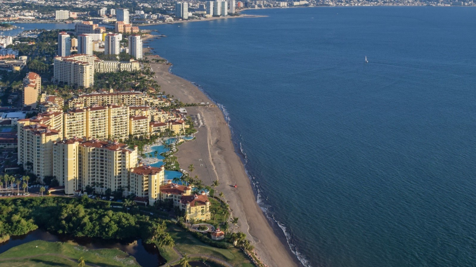

Puerto Vallarta stretches along the eastern shore of Banderas Bay, on Mexico's Pacific coast, with the Sierra Madre rising straight behind it. From north to south: the resort district of Nuevo Vallarta, across the state line in Nayarit; the airport and Marina Vallarta; the Hotel Zone; downtown and the Malecón; Zona Romántica (Old Town); and then the hillside neighbourhoods and the coast road south to Mismaloya and Boca de Tomatlán, where the road ends and the boat-only beaches begin. The map below shows them all; tap a marker for a short description and a link to its guide.
In the city Beaches Islands and boat trips Around the bay and beyond Airport, port and nature
Map data © OpenStreetMap contributors. Marker positions are approximate, for orientation.
The city, north to south
Most visitors stay in four areas, all within about half an hour of each other by taxi. Marina Vallarta sits next to the airport, around a yacht marina and golf courses. South of it, the Hotel Zone lines the beach with resorts along the main boulevard. Then comes downtown, with the Malecón and the crowned church, and, across the Río Cuale and Isla Cuale, Zona Romántica, the walkable heart of the old town. The hillside neighbourhoods of Amapas and Conchas Chinas continue south above the coves. See where to stay for how they compare.
Around the bay
North of the Ameca river, which is the state line, the towns of Nayarit follow the curve of the bay: Nuevo Vallarta, Bucerías, La Cruz de Huanacaxtle and Punta de Mita at the northern tip, with Sayulita and San Pancho on the open Pacific beyond. They all keep Puerto Vallarta's time. Drive times from the airport to each are in our flights guide.
Boat-only places
South of Boca de Tomatlán there is no road. Las Ánimas, Quimixto, Majahuitas and Yelapa are reached by water taxi from Boca or from the Los Muertos pier; the Marietas Islands and Los Arcos by boat trip. See the south shore and islands near Puerto Vallarta.
Every place on the map
In the city
- Zona Romántica (Old Town) — Cobbled streets, restaurants, nightlife and Los Muertos beach.
- Downtown and the Malecón — The seafront promenade, the crowned church and the main square.
- Isla Río Cuale — The river island between downtown and Old Town.
- Hotel Zone — The resort strip between the city and the marina.
- Marina Vallarta — Marina, golf and quieter resorts by the airport.
- Amapas — Hillside condos with views, above the south end of Los Muertos.
- Conchas Chinas — Rocky coves and villas just south of Old Town.
Beaches
- Playa Los Muertos — Old Town's lively city beach and its pier.
- Mismaloya — The film-set cove, by city bus from Old Town.
- Las Ánimas — The busiest boat-only beach, by water taxi or on foot.
- Yelapa — A village with no road and a waterfall.
Islands and boat trips
- Los Arcos — Granite islets for snorkelling, off Mismaloya.
- Islas Marietas — The national park and its Hidden Beach.
- Boca de Tomatlán — Where the road ends and the water taxis leave.
- Quimixto — Fishing village and waterfall, boat only.
Around the bay and beyond
- Nuevo Vallarta — The bay's biggest cluster of resorts, in Nayarit.
- Bucerías — A relaxed beach town north of the airport.
- La Cruz de Huanacaxtle — Marina, fish market and Sunday market.
- Punta de Mita — The tip of the bay, and the closest boats to the Marietas.
- Sayulita — Surf town, about an hour north.
- San Pancho — Sayulita's quieter neighbour.
- San Sebastián del Oeste — Old mining town in the mountains, about 2 hours away.
Airport, port and nature
- Puerto Vallarta airport (PVR) — The only airport for the whole bay.
- Cruise terminal — Where cruise ships dock, opposite Walmart and Sam's Club.
- El Salado estuary — Protected mangroves and crocodiles; boat tours.
- Vallarta Botanical Garden — Orchids, forest trails and a river, south of town.
Getting around
City buses run along the coast from Marina Vallarta to Old Town and south to Boca de Tomatlán; regional buses go north to the Nayarit towns; taxis and Uber cover the rest. See getting around, buses and Uber and taxis, and the airport guide for getting into town.
Frequently asked
Where is Puerto Vallarta?
On Mexico's Pacific coast, in the state of Jalisco, on the eastern shore of Banderas Bay. Its airport is 7.5 km north of the city.
How is Puerto Vallarta laid out?
In a long strip along the bay. From north to south: Nuevo Vallarta (in Nayarit), the airport and Marina Vallarta, the Hotel Zone, downtown and the Malecón, Zona Romántica, then the hillside neighbourhoods and the coast road south to Mismaloya and Boca de Tomatlán.
Which part of Puerto Vallarta is walkable?
Downtown, the Malecón and Zona Romántica, which are joined by the river footbridges and Isla Cuale. The resort areas to the north are a taxi or bus ride away.
How far is Sayulita from Puerto Vallarta?
About 34 km from the airport, roughly an hour by road. Nuevo Vallarta is about 15 to 20 minutes from the airport, and Bucerías 20 to 30.
Latest articles
Puerto Vallarta in March
Still dry and sunny, with a busy calendar: trail races, the regatta, spring breaks and Easter.
Read →
Puerto Vallarta in February
The driest month and the peak of whale season — with the coolest sea of the year.
Read →
Puerto Vallarta in January
Peak dry season: warm days, cool evenings, almost no rain and the whales in full swing.
Read →